Skip to main content Skip to Sitemap

Fall Colour Guide: Best Places in Southeastern Ontario | Bay of Quinte

Illustrated image of fall trees with a hiker in front.

The Ultimate Bay of Quinte Fall Colour Guide

Looking for fall colours in Southeastern Ontario? The Bay of Quinte is a scenic region between Toronto and Ottawa, where five waterfront communities offer trails, conservation areas, parks and waterfront views that come alive with colour each fall. Explore Belleville, Brighton, Greater Napanee, Quinte West and Tyendinaga Mohawk Territory to find some of the region’s best places to experience autumn.

Written by Jenn Lindsay

START WITH THE BIG VIEW!

Climb the 30-Foot Lookout Tower at Sager Conservation Area

30 Golf Course Rd, Quinte West

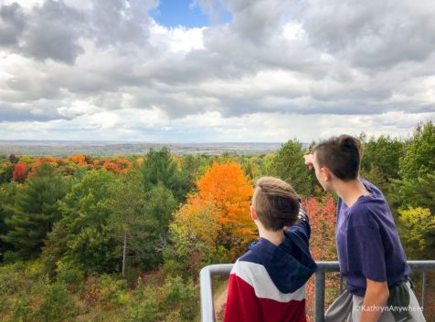
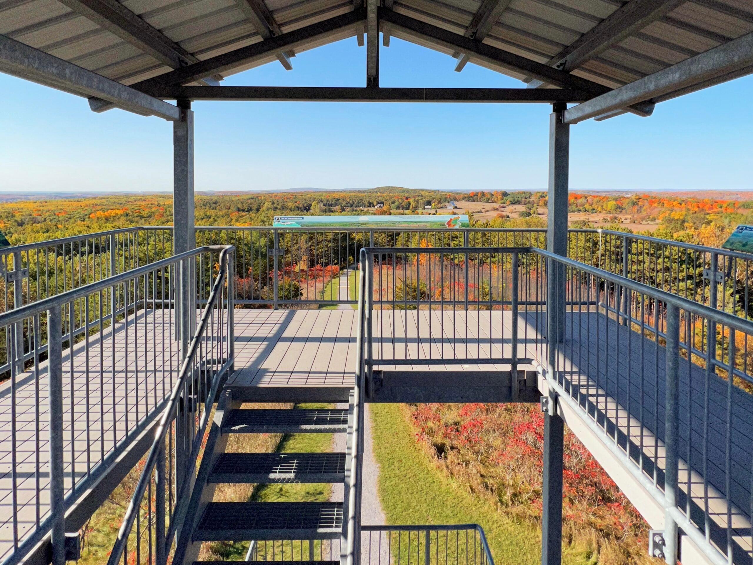
A short 1 km trail starts at the base of the hill and climbs steeply to a scenic 30-foot tall lookout tower, offering spectacular panoramic views of the Trent River valley and surrounding area. There’s a total of 97 steps on the trail plus another 48 steps on the tower; a bit of a hike but the view is worth it for the sea of fall colours.

GOOD TO KNOW

Trail: 1 km
Lookout: 30-foot tower
Steps: 97 on the trail + 48 on the tower
Difficulty: A bit of a climb

The lookout tower at Sager Conservation Area in Quinte West sits on top of one of the highest drumlins in the region.

EXPLORE FALL COLOURS AROUND THE BAY

The Bay of Quinte puts on quite a show when the leaves start to turn. Wander waterfront trails, wander through forests and conservation areas, and keep your eyes peeled for those perfect pockets of red, orange and gold. Here are a few favourite places throughout the five communities to get out and enjoy the season at its colourful best.

BELLEVILLE — WATERFRONT VIEWS, SCENIC WOODLANDS & OPEN MEADOWS

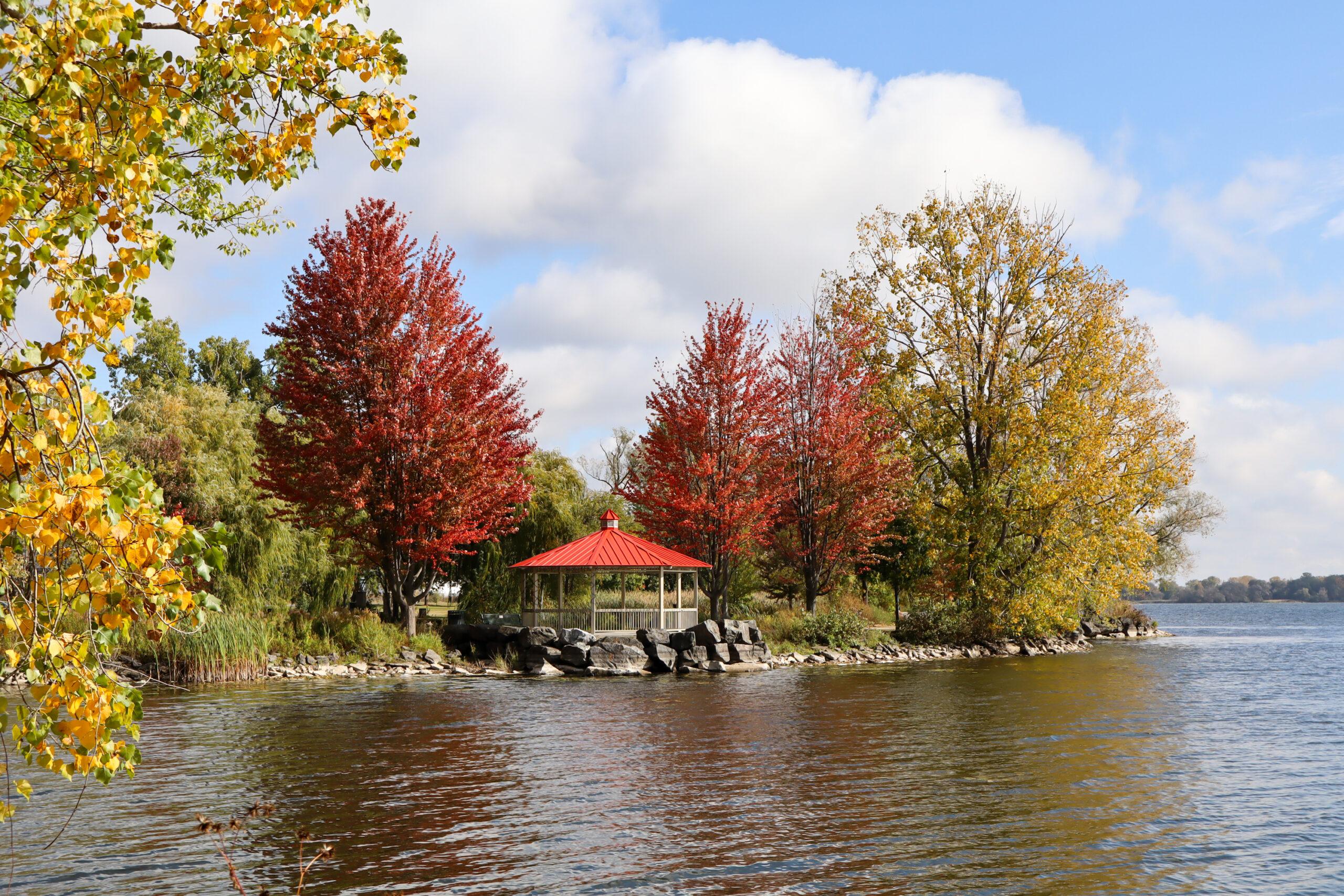
The gazebo is a perfect place to enjoy a front-row view of the Bay dressed in its fall colours.

WATERFRONT VIEWS

Kiwanis Bayshore Trail

South End of Herchimer Ave to S Front St, Belleville

Kiwanis Bayshore Trail follows 2.75 km of paved waterfront along the north shore of the Bay of Quinte, with plenty of places to pause and take in the view. The trail passes a turtle pond, gazebo lookout and scenic waterfront spots, making it an easy choice for a fall stroll. Keep an eye out for birds along the shoreline, or simply enjoy the changing colours with the Bay as your backdrop. t’s an easy, accessible way to get outside and see Belleville as the season changes.

GOOD TO KNOW

Trail: 2.75 km
Surface: Paved
Highlights: Views of the Bay, gazebo lookout and a Turtle Pond
Difficulty: Relatively flat

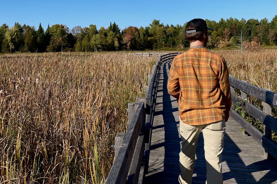
a man standing on a bridge looking at a field.
Bring your binoculars and see what migrating birds you can spot. —Photo by Jenn Lindsay.

MARSH BOARDWALK

H.R. Frink Conservation Area

381 Thrasher Rd, Belleville

H.R. Frink Conservation Area has a short gravel path to the Wetland Ecology Boardwalk that opens up to a marvellous view of the marsh. The fall hues take over as it provides an important rest and feeding stop for birds as they migrate south for the winter. Extend your visit and explore up to 10 km of trails where the forest floor is blanketed in a mosaic of orange, yellow, red, and brown throughout the fall.

GOOD TO KNOW

Trail: 10 km total
Surface: Natural trails + boardwalk
Highlights: Wetland Ecology Boardwalk, Moira River and Cedar Creek lookout
Difficulty: Beginner to advanced; some steep and uneven sections

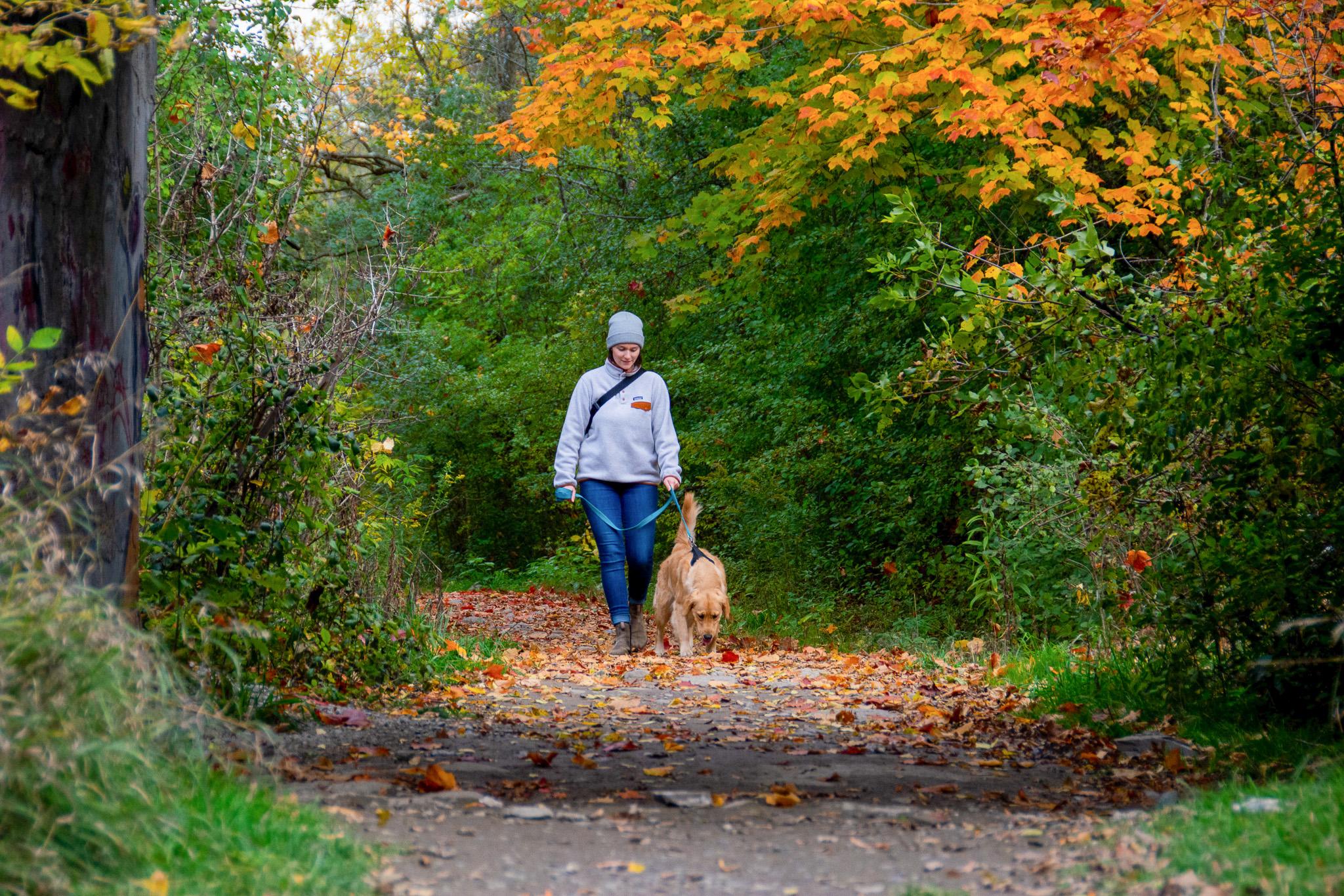
Keep the trails safe for everyone with your dog on a leash at all times.

INTO THE WOODS

Potter's Creek Conservation Area

935 Moira St W, Belleville

Potter’s Creek Conservation Area brings a little bit of countryside to the edge of Belleville, with trails winding through old orchards, open meadows and scenic woodlands. Come fall, the trees put on their annual colour show, while birds and wildlife make the most of this varied landscape. Explore up to 7 km of trails through the changing landscape, with plenty of spots to slow down and soak up the season.

GOOD TO KNOW

Trail: 7 km total
Surface: Natural trails + paved loop
Highlights: Orchards, meadows, woodlands and Potter’s Creek
Difficulty: Beginner to advanced; some steep and uneven sections

BRIGHTON — MOODY FALL VIBES, DEEP FOREST CANOPY & TOTAL FALL DAZZLE

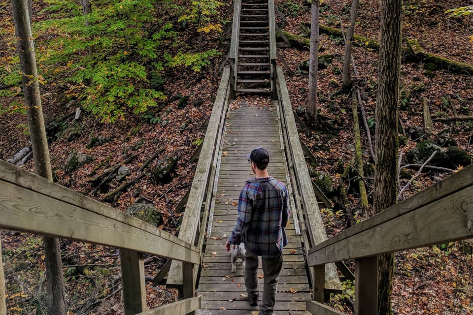
a man standing on a wooden bridge in the woods.
Sections of wooden boardwalk and staircases on the trail add some interest to the hike! —Photo by Jenn Lindsay.

UNDER A HARDWOOD CANOPY

Proctor Park

96 Young St, Brighton

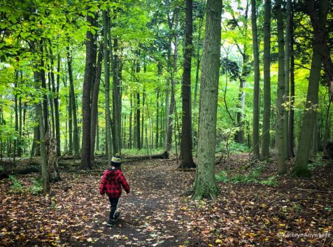
Proctor Park is the ultimate moody fall vibe, with a rustic wooden walking bridge passing over a creek and a deep forest canopy. The 3 km Hardwood Hill Trail is where the colours of fall dazzle, dipping into a valley and across the wooden bridge, where the squirrels are busy storing their winter harvest. The trail ends back at Proctor House, a scenic spot for fall photos and a picnic.

GOOD TO KNOW

Trail: 2.5 km
Surface: Natural forest trail
Highlights: Butler Creek, cedar lowlands and hardwood forest
Difficulty: Moderate; rolling terrain and some hills

GREATER NAPANEE — WATERFALLS, LOCAL HISTORY & EASY RIVERSIDE ESCAPES

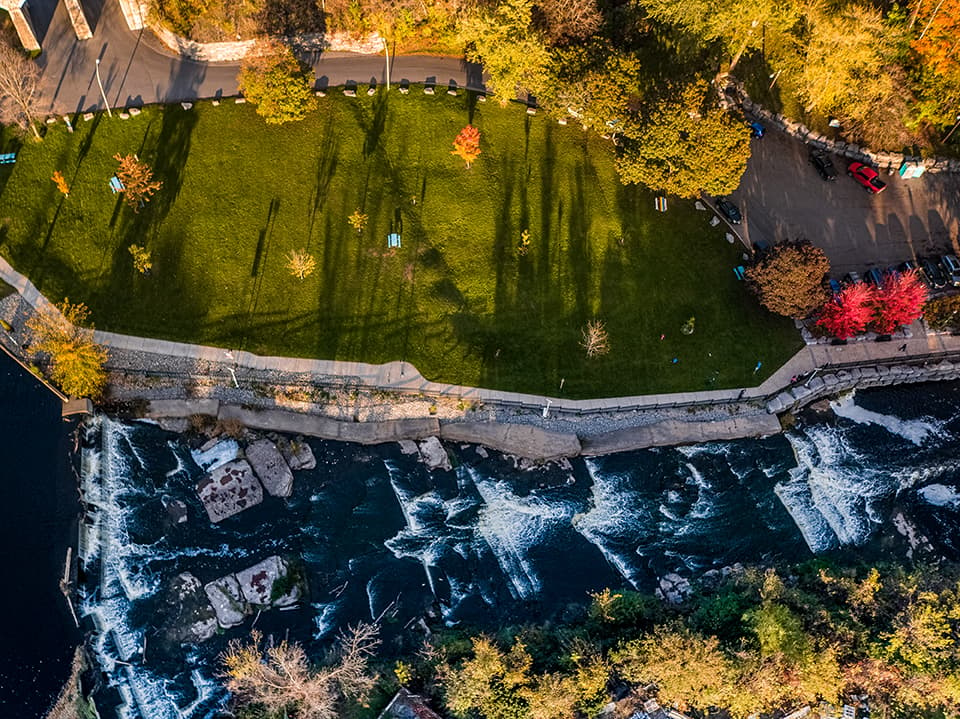
Springside Falls from above —Photo by Justen Soule.

RUSHING RIVER ADJACENT

Springside Park

8460 County Rd 2, Greater Napanee

Follow the 0.75 km accessible waterfront trail along the Napanee River from Springside Park to Conservation Park, with the river and waterfalls providing a scenic backdrop along the way. The route passes the site of the area’s first lumber mill, adding a little local history to your stroll. Take your time, grab a bench or pack a picnic and enjoy this easy riverside escape in the heart of Greater Napanee.

GOOD TO KNOW

Trail: 2.5 km
Surface: Natural forest trail
Highlights: Butler Creek, cedar lowlands and hardwood forest
Difficulty: Moderate; rolling terrain and some hills

INSIDER TIP: The best seat for fall colours might be on the water. Until October 11, hop aboard Napanee River Tours and see the shoreline dressed in its autumn best.

QUINTE WEST — PEACEFUL WOODLANDS, EASY HIKES & BIG ROCKS

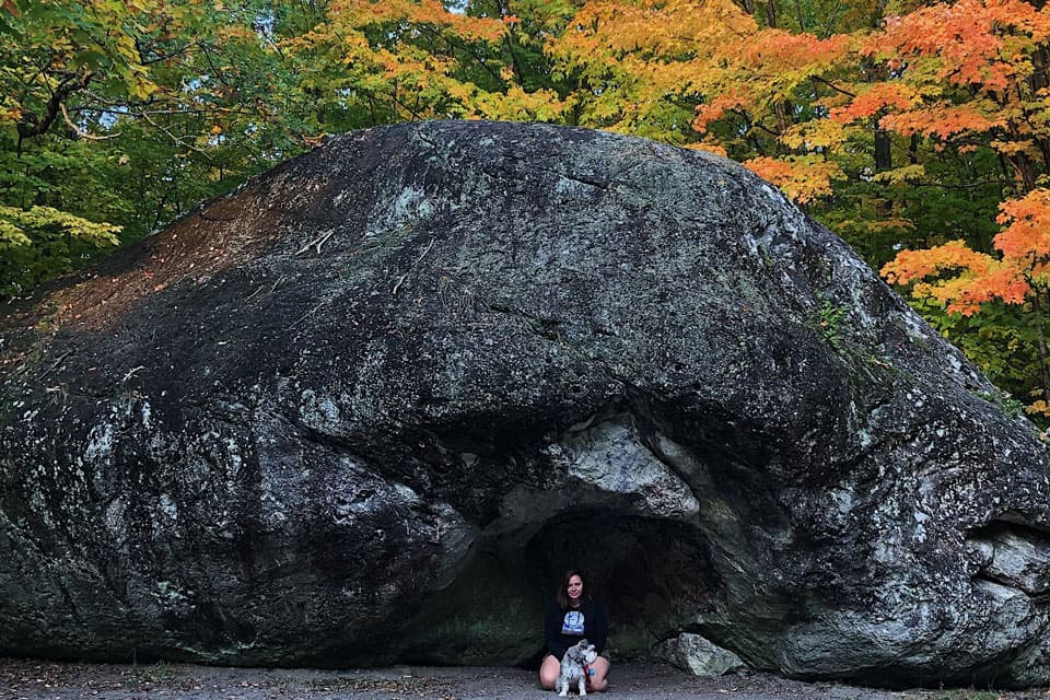
a woman and her dog sitting in front of a large rock.
The Bleasdell Boulder is one of the largest glacial erratics in North America, left behind by melting glaciers in the Ice Age. —Photo by Jenn Lindsay.

2.3 BILLION YEAR OLD GLACIAL ERRATIC—AKA ENORMOUS ROCK

Bleasdell Boulder Conservation Area

760 Trenton Frankford Rd, Quinte West

Meet one seriously old rock. The 1.5 km trail at Bleasdell Boulder Conservation Area winds through peaceful woodland before arriving at a 2.3-billion-year-old glacial erratic—one of the largest known in North America. Along the way, keep an eye out for flora and fauna and fall colour filling in the forest. It’s a short, easy hike with a pretty impressive payoff.

GOOD TO KNOW

Trail: 1.5 km loop
Surface: Crushed stone/gravel
Highlights: 2.3-billion-year-old boulder, woodland and wetlands
Difficulty: Easy; wheelchair-friendly trail to the boulder

READY TO PLAN?

Visit the Vacation Toolkit

Find places to stay, events, maps and more to help plan your perfect trip!

binocular icons
a man riding a wave on top of a surfboard.

Let’s see what we got!

a black and blue logo with the words bay of county.

The Bay of Quinte RMB Land Acknowledgement

The Bay of Quinte Regional Marketing Board is committed to acknowledging, appreciating and understanding the Indigenous Peoples’ historic connection to this land and to raising awareness by building relationships in collaboration with Indigenous partners and communities. 

We recognize and acknowledge that we are living and working on the traditional territory of the Wendat, Mississaugas, Anishinaabeg and Haudenosaunee which includes the Kenhtè:ke Kanyen’kehá:ka (Mohawks of the Bay of Quinte) with whom we work in direct partnership with. 

This partnership focuses on the common goal of celebrating the region with the Kenhtè:ke Kanyen’kehá:ka who are equal partners within the organization and at the Board of Directors table contributing to the mandate and operations.

This mandate includes listening to, learning from, and collaborating with the Kenhtè:ke Kanyen’kehá:ka and actively incorporating their culture and heritage into the practice of responsible destination marketing and management of the region.

We understand that this land acknowledgement is only a small step towards the larger process of reparations and reconciliation.

COOKIE SETTINGS

Bayofquinte.ca uses the cookies described below on this website. You can decide which categories of cookies you wish to accept. To learn more about the cookies we use on our site, please read our Privacy Policy.

Functional Cookies

These technologies are required to activate the core functionality of the website. E.g. Youtube, CloudFlare.

Analytics Cookies

Google Analytics cookies are used for tracking popular page visits to better serve our users with relevant content

Marketing and Advertising Cookies

These cookies are used for gathering user data to create a better experience with more relevant offers. E.g. Facebook pixel tracking